Fatah Facebook posts maps of “Palestine” erasing Israel
 Images and text posted on the official Fatah Facebook page
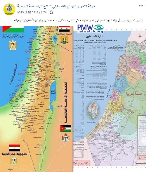
The image on the left shows the PA map of “Palestine” that presents all of Israel as “Palestine” together with the PA areas. In the upper left corner are the Palestinian flag and the PLO emblem in the shape of an eagle; the flags and emblems of Egypt, Jordan, and Syria appear as well.
Text on image: “The Nakba (i.e., “the catastrophe,” the Palestinian term for the establishment of the State of Israel) of Palestine”
The image on the right shows the PA map of “Palestine.” Among the cities listed on the map are: “Tal Al-Rabia (i.e., Arabic translation of Tel Aviv; see note below),” “Askalan (i.e., Ashkelon),” and “Umm Al-Rashrash (i.e., Eilat).”
Text on image: “Map of Arab Palestine”
Posted text: “We would be happy if every one of us would note the name of their village or city, so that we will get to know Palestine’s beautiful cities and villages.”